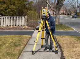
When it comes to property dealings, whether you’re a real estate professional, a homeowner, or a land developer, understanding the nuances of surveying is crucial. Surveys ensure that property boundaries are clear, disputes are minimised, and developments are planned correctly.
Two of the most common types are land surveys and boundary surveys. This blog post will explore their differences, the processes involved, and why accuracy in these surveys can make or break your property transactions.
Why Understanding Survey Types Matters
Before we jump into the specifics, let’s talk about why you should care about survey types. Surveys are essential for documenting the exact dimensions and features of a piece of land. They help prevent legal disputes, provide a clear understanding of property boundaries, and are crucial for development projects. Knowing the difference between a land survey and a boundary survey can save you time, money, and a lot of headaches.
What Is a Land Survey?
A land survey, also known as a topographic survey, is a detailed analysis of a specific parcel of land. This type of survey includes the measurement of both the horizontal and vertical dimensions of the land, capturing everything from elevations to the location of trees, buildings, and other permanent features.
Components of a Land Survey
Land surveys are comprehensive. They can include details about the terrain, water bodies, and any other physical features on the property. They’re often used for planning construction projects, roadways, and utilities.
Technology Used
Modern land surveys employ advanced technology such as GPS, drones, and laser scanning to gather precise measurements. These tools enable surveyors to capture data efficiently and accurately.
Applications in Real Estate
In real estate, land surveys are invaluable for assessing the feasibility of a development project, planning landscaping, and ensuring compliance with zoning laws.
What Is a Boundary Survey?
A boundary survey focuses specifically on determining the exact lines that define a property. It is less concerned with the topographic features and more about the legal boundaries.
Components of a Boundary Survey
Boundary surveys identify property corners and lines using markers like stakes or monuments. These surveys are often required for property sales, building permits, and resolving boundary disputes.
Technology Used
Like land surveys, boundary surveys also utilise modern instruments such as GPS and total stations to ensure accuracy. However, they might not require the same level of detail as land surveys.
Applications in Real Estate
Boundary surveys are crucial for real estate transactions, as they provide a clear definition of what is being bought or sold. They ensure that everyone involved understands the property’s exact limits.
Process and Technology Involved
Understanding the process and technology behind each type of survey can help you appreciate their differences and applications better.
The Land Survey Process
- Initial Research:
Surveyors begin by researching public records, previous surveys, and land titles.
- Fieldwork:
This involves physically visiting the site, taking measurements, and noting any significant features.
- Data Analysis:
The collected data is then analysed using specialised software to create detailed maps and plans.
The Boundary Survey Process
- Document Review:
Similar to land surveys, boundary surveys start with an in-depth review of legal documents and previous surveys.
- Field Measurements:
Surveyors locate existing boundary markers and take precise measurements.
- Boundary Determination:
After analysing the data, surveyors set new markers if necessary and create a detailed report outlining the property’s boundaries.
Examples of Usage Scenarios
Having a firm grasp of the differences between land and boundary surveys can be illuminating when considering their practical applications.
Land Survey Example
Imagine a developer planning a new residential subdivision. A land survey would be conducted to understand the terrain, identify potential building sites, and plan roads and utilities. The detailed information helps in making informed decisions about the layout and design.
Boundary Survey Example
Now consider a homeowner looking to build a fence around their property. A boundary survey would clearly define the property lines, ensuring the fence is built within legal boundaries and avoiding disputes with neighbours.
Legal and Practical Implications
Not having the correct survey for your needs can lead to significant legal and practical issues.
Avoiding Legal Disputes
Incorrect or outdated surveys can result in encroachments, leading to legal battles over property boundaries. Accurate surveys help prevent these conflicts.
Planning and Zoning Compliance
Accurate land surveys ensure compliance with local planning and zoning laws, preventing costly delays and modifications during construction.
Financial Considerations
Investing in the right type of survey can save you money in the long run by avoiding legal fees, fines, and the cost of correcting mistakes.
Choosing the Right Surveyor
Selecting a qualified surveyor is crucial for obtaining accurate results.
Credentials and Experience
Look for surveyors with relevant credentials and experience in the type of survey you need. Membership in professional organisations can also be a good indicator of their expertise.
References and Reviews
Check references and read reviews to gauge the surveyor’s reliability and quality of work. Positive feedback from previous clients can give you peace of mind.
Cost Considerations
While cost shouldn’t be the only factor, it’s essential to get a clear understanding of the fees involved. Ask for a detailed quote to avoid any surprises later on.
Cost Differences Between Land and Boundary Surveys
The cost of surveys can vary depending on several factors.
Land Survey Costs
Land surveys tend to be more expensive due to the detailed information they provide. The price can range from a few hundred to several thousand pounds, depending on the size and complexity of the property.
Boundary Survey Costs
Boundary surveys are generally less expensive, as they involve fewer details. Prices typically range from a couple of hundred to a thousand pounds.
Factors Influencing Cost
Factors like property size, location, and the complexity of the survey can affect the overall cost. It’s essential to get multiple quotes and understand what’s included in each.
Conclusion
Understanding the difference between land surveys and boundary surveys is crucial for real estate professionals, homeowners, and land developers. Accurate surveys ensure that property transactions and development projects go smoothly, preventing legal disputes and financial losses. By choosing the right type of survey and a qualified surveyor, you can safeguard your investments and make informed decisions.
Frequently Asked Questions
What is the most accurate land survey?
The most accurate land survey is the geodetic survey, which considers the curvature of the Earth and provides highly precise measurements. For most property needs, a standard land survey with modern technology like GPS and laser scanning offers more than sufficient accuracy.
How accurate are boundary surveys?
Boundary surveys are highly accurate when conducted by a qualified surveyor using modern technology. They typically have an accuracy range of within a few centimetres, ensuring precise property lines.
Is land surveying the same as surveying?
Land surveying is a type of surveying focused on measuring and mapping land features. Surveying, in general, can include various other types, such as hydrographic surveying (water bodies) and engineering surveying (construction projects).